
Setting out & dimensional control
From design to the field: set out points and lines accurately with RTK-GNSS or a total station and verify as-built against the design.
What we do
We set out design points, lines and contours accurately in the field with RTK-GNSS or a total station, tied to the design in the client’s system. We also carry out control surveys and record the actual situation as-built, directly comparable with the original design.
Our approach
From a supplied CAD/DXF drawing or coordinate list we extract the geometry to be set out. In the field we stake out the points and verify on the spot. The digital feedback consists of stake-out lists, a control report and as-built, so deviations from the design are immediately visible.
Setting out yourself
For a client we built a tool that easily converts lists of coordinates into drawings and prepares them for import into the field book. This makes it easier for the client to do their own setting out as well.
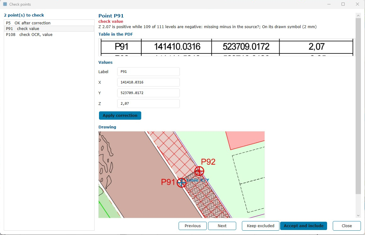
Example from our tool: the value from the PDF table is placed next to the drawing and a possibly wrong sign is flagged.
Applications
- Setting out points, lines and contours from the design
- Dimensional control for construction, earthworks and infrastructure
- Control surveys and as-built verification against the design
- Transfer from CAD/DXF to the field and back
- Converting coordinate lists into drawings and preparing them for import into the field book, so clients can set out themselves